SpicyTruffel Avatar
Created By SpicyTruffel
Follow

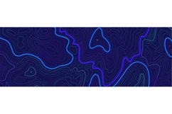
Topographic relief contouring line. Elevation map or ocean f

$5.00 USD
Premium License
Corporate License
Add to Cart - $5.00 USD
0

Share this product

More information on this Design

Topography relief contouring line. Geographic outlines, elevation map or ocean floor surface with cross signs. Modern landscape liquid gradient, radar readings. Vector cartography texture illustration

Files in archive:

  • ESP (vector file for Adobe Illustrator)
  • - High Resolution JPG file

Product Information

  • Release Date:
    2nd August '22
  • Updated Date:
    2nd August '22
  • Product Tags:
    Map Contour Topography Cartography Relief Surface Floor Radar Elevation Geographic
  • File Types Included:
    EPS JPG
  •  
    Report listing for infringement

Customer Reviews

For this Product
For this Store

There are no ratings for this product yet.

4.4
(29 Reviews)
5.0
23
4.0
2
3.0
0
2.0
0
1.0
4

How to use

Introducing Design School – our jam packed platform with its own mini search engine! Design School was made to help you learn all there is to know about fonts, graphics, templates, designs, file types, different software programs, Frequently Asked Questions and much much more.

Commercial use license

All Products can be used for Commercial Use! Read our licenses.

Five Star Technical Support

If our help center can't help you, our Customer Support staff will.

Unlimited Downloads

Your purchases are kept secure by us and can be downloaded an unlimited number of times.

store avatar
SpicyTruffel

More Design Resources by SpicyTruffel

Similar Design Products to Topographic relief contouring line. Elevation map or ocean f

Topographic relief contouring line. Elevation map or ocean f example image 1

Viewing Product

Topographic relief contouring line. Elevation map or ocean f

By SpicyTruffel

Add to Cart - $5.00 USD
Help Center